Exploring UNESCO heritage sites
 Utopix-Geoffrey
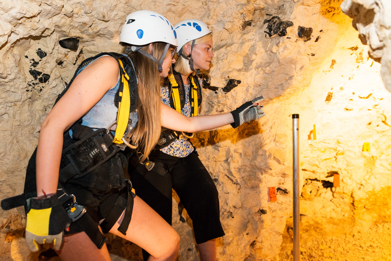 Utopix-Geoffrey
 Utopix-Geoffrey
About the activity
Distance
19.4 km
Elevation
30m
Your tourist walk in Mons begins in the heart of the Cité du Doudou. Its famous ritual Ducasse of Mons, highlighted at the Musée du Doudou, is recognised as one of the Masterpieces of the Oral and Intangible Heritage of Humanity by UNESCO.
Continue your itinerary to the Belfry of Mons, the only baroque belfry in Belgium. Listed as a UNESCO World Heritage Site in 1999, it is part of the group of belfries of Flanders and Wallonia and offers breathtaking views over the city.
Do not miss a detour via Rue de Nimy, where the Mundaneum is located, often referred to as the “paper Google”. This archive and temporary exhibition centre has been part of UNESCO’s Memory of the World register since 2013.
Following the node points, you will reach the Terril de l’Héribus, a witness of the industrial past of the Borinage. From its summit, enjoy an exceptional panorama of the belfry, the collegiate church Collégiale Sainte-Waudru, the surrounding spoil heaps and Mont Panisel.
Before finishing your route in the city centre of Mons, make an essential stop at SILEX'S de Spiennes. This major archaeological site, recognised by UNESCO since 2000, is one of the oldest and largest flint mining complexes in Europe. Take the opportunity to descend into the mines for a unique experience.
Junctions to follow:
46 > 11 > 13 > 62 > 23 > 47 > 21 > 55 > 19 > 6 > 69 > 58 > 48 > 17 > 11 > 46
General Information
Contact Information
Address
27 Grand-Place,7000 Mons
Documentation
GPX / KML files allow you to export the route of your hike to your GPS (or other navigation tool)
Interactive route map
View the route trace, elevation profile and download the route for your GPS.